So we learn about this place near Ujire which is supposed to be a really nice trekking trail that doesn't usually feature when folks are talking about trekking in Karnataka. While a lot of folks seem to have trekked it, there's not a lot of information floating around.
And the title kinda says it all. We chose November on the premise that the rains would've abated. However, it rained, and it rained copiously all over the Peninsula leading up to the trek. And just to trick us into going, the rains stopped for a couple of days prior to us leaving. Obviously, we weren't going to let a little bit of the damp to dampen us. (Yeah, tired old joke). However on the night we left in the comfortable confines of a new Innova, it rained. Which brought out the collective population of leeches in the entire southern Western Ghats on to the trail leading to Bandaje Arbi. For that is where we were going and where Mr. Murphy decided leeches should be.
This post is going to be short on both details and photos. For the simple reason that on the way up, all of us were worried about not getting feasted upon, so we didn't stop too much. And our confines-of-A/C-offices flogged bodies couldn't take the rush-up-the-hill-before-we-get-bitten pace. So there are no photos going up. Once we got up there, we barely had time to find a place to camp - which was relatively leech free - before we could cook and before the rain Gods descended upon us again. Which left us grappling with another issue. One of our allegedly (meaning the Usual Suspect was lying through his teeth) waterproof tents turned out to be not. So in a tent meant for 3, there were 7 sweaty, hungry trekkers. But then what is life without some breaks? And it did come through with the showers stopping in about 20 mins and then with some amount of water evacuation both the tents were fairly sleepable. Which is a long winded way of saying that we didn't even get to the waterfall. Where by the way, there are excellent spots to camp.
The next morning we woke up as refreshed as we could've been in the circumstances. But again, we didn't go all the way upto the waterfalls. For those interested, the trek begins at Bandaje. This is near Ujire and Dharamasthala. You'll need to call up Narayana Gowda, whose farm is at the base of the trek who'll then arrange for one his trusted lieutenants Vasu to come with you. The actual trek is from Bandaje to Ballalrayana durga to Sunkashale. Or the other way around. Because the elephant grass between Bandaje Arbi and Ballalrayana durga was not cut, we were hesitant to go all the way over to Sunkashale. Like all places remote, transport to and from your entry and exit points are minimal so you'll need to make arrangements.
And yeah, try not going when the leeches are feasting.
Friday, October 17, 2008
In which Leeches feast

Monday, August 25, 2008
In which we partake of freebies
Us desis like our freebies. The more the better. When we book hotels on the Continental plan, we're the ones lining up for breakfast like the way "real estate agents" line up when somebody mentions SEZ. Or how we stampede into Big Bazaar when they offer 50% off on their 100% crap. Now thanks to The Wife, we lucked into gift vouchers to any Taj anywhere in India. Now based on empirical data, you could have a dinner for two at the Taj, Bombay (and shell out some from your pocket to settle the bill) or have a dinner for a family at Taj Westend in Bangalore (and shell out some from your pocket to settle the bill) or go to Taj Coonoor for a long weekend (and don't shell out any from your pocket at all, gotcha there didn't I!). I'm not implying this place is cheap, it is not by any means. But it definitely is worth the money we didn't spend.
Its easy to see why people state that Coonoor is better than Ooty (or Udhagamandalam or Udhagai). It's nice, its small, and if you end up staying in an expensive place, there are still a lot of places you can cover on foot that will not break the pocket. Coonoor is at a lower elevation than Ooty and hence not as cold as Ooty can get during the rains or winter. There are plenty of ways to get here from the Deccan plateau, one is the scenic route through Mysore, Gundulpet, Bandipura, Gudalur, Ooty and thence to Coonoor. Or take the other scenic route through Mysore, Gundulpet, Bandipura, Thepakadu, Kalhatti, Ooty and thence to Coonoor. Or you can take the more leisurely and scenic route from Coimbatore, Mettupalayam and directly to Coonoor. This last part can be done in the heritage railway. The actual distance by rail is about 28 km from Mettupalayam but it takes a long gentle 3 hours to get you there. On the way it covers tons of tunnels and passes over some spectacular scenery before depositing you at the Coonoor station.
You then make your way to Upper Coonoor, past the bustling bus stand and end up at the Taj. The  hotel itself was a priory earlier and unlike anywhere else I've been, the driveway into the hotel passes a cemetery. Now, that, you've to admit, is not exactly the welcome you're looking for when you entering the gates of what is one the better hotel brands in the country. However, it's not as if you go past acres of them, and the residence proper will ensure that morbid thoughts are immediately gone the moment you go lay eyes on the entrance. The whole place has a nice laid back feel to it and the red tiled roof and white washed walls with ivy climbing on to them give it a charm of its own.
Coonoor is a town best discovered on foot. If you're staying anywhere in Upper Coonoor, Sims Park is not too far. It is a park laid out in a ravine, and over 12 hectares. It is worth the 5 INR and 30 INR that they charge for adults and their still cameras. Video cameras are charged extra. Over a holiday weekend, it will have it's share of boisterous kids and adults who're trying very hard to enjoy their vacation. However, like I mentioned it's large enough for people to have their privacy. There are the other usual points that most hill stations in India seem to have. Vantage points of view of the plains below, where folks from the plains come to gawk at the very plains they've left behind. Dolphin's Nose, Lamb's Rock, Lady Canning's Seat et cetera would, no doubt, keep you occupied the whole day seeing as they're around 8-10 km all along the compass from Coonoor. There are taxis available for hire at Bedford in Upper Coonoor or near the bus stand. You'll have to haggle depending upon when "season" is. For those inclined towards exertion, the Droog Fort, 15 km from Coonoor would be a good bet. Its also known as Bakasura Malai and the route to the fort passes through the Nonsuch Tea Estate. Nonsuch tea is also highly rated among tea connoisseurs.
The other direction you could go to would be towards Kotagiri and Kodanad. The Kodanad view point offers you a spectacular view of the Bhavanisagar dam's reservoir and onwards to the Mysore plateau. During the monsoon, this view is obscured by clouds of mist and rain, but the whole experience is quite stunning. There is a trek that is conducted by local Forest department. You can contact them at 0423 2443968 or 04266 278020. This is called the Thengumarada Trek and leads down from Kodanad towards Thengumarada. The drive from Coonoor to Kotagiri is quite good with the drive from Kotagiri to Kodanad takes you through some wonderful landscape. About 5 km short of the view point, there is a small lay by where you can sit an take in the peace and quiet.
Another option is to take a bus towards Wellington and spend a pleasant couple of hours walking through one of the prettiest cantonments in the country. The cantonment is about 3 km from Sims Park and you can either walk the whole way or take the bus. When you come back, you can walk about 5 mins on the Kotagiri road and park yourself at Tranquilitea, a tea lounge where your host, Sandeep will help you choose the choicest of Nilgiri teas and even fill you in on the history of the Hills. You can also click here for other staying options.
The long weekend did come to an end too soon. However, we were unable to break the shackles of the daily grind and we very reluctantly turned back. Even though we had some money still left on the freebie. Now, that, you've to admit is very hard for a desi to do.

Saturday, January 13, 2007
Kumara Parvata or why I need to be fit

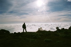
Anyhow, I used the weekend of 15th Dec (see, see, the lazy bum write NOW!) to finally get around to trekking the Pushpagiri. Which a lot of folks know as Kumara Parvata. Over the last 3 years, we'd made atleast 2 other plans that I know of to trek, which for the usual reasons (hey, I was not to blame, OK) fell through.
As always, we suddenly decided that we had to trek Kumara Parvata and as it happened it was a Wednesday. We figured we will ask for permission to camp and asked at the Forest office in Malleshwaram. As it turned out that was entirely superfluous. More on that later. Because we decided late, no tickets were available to Subramanya, where the climb starts. Word of advice, be sure to get a booking in one of those Volvos. We booked our selves on the last seats on the last bus to Hell. The seats kept sliding and the driver was obviously someone who rode a moon buggy, for the crater sized pot holes on the ghats didn't tempt him from stepping off the accelerator. The last part of the ride - post Doingal near Sakleshpur are, to put it mildly, torturous. Be that as it may, we arrived a little worse for the wear at around 7 at Subramanya. For the finicky amongst us, the temple complex has facilities - quite decent I might add.
The route to the climb is to the right of the temple (if you are facing the temple). You will need to walk up a bit and there is a gap between the shops and pretty much follow the road. I'd heard from a lot of people that KP is quite tough and while I will not disagree, it is primarily due to the fact that it is quite long. The first 200 to 300 mts is densely forested and slightly damp so there are chances of leech bites even in winter. Once you come out in the open, it is quite sunny and if you choose the wrong season, it might be quite harsh even. A little after you cross the wooded area, you will chance upon Bhat's house (Bhatre mane). He provides breakfast upto 9.30 I think and start lunch at 12.30. 30 INR for one lunch, didn't ask about breakfast. So the point is if you are going to get here between these times, it would make sense for you to go ahead and not stop. We spent about 2 hours idling about here.
And here is the other reason, why you should keep on going. There is a forest office (house? outpost?) just a couple of minutes up Bhat's house. You'll need to get permission from here to camp. As I mentioned earlier, this permission seems moot. There is a 70 INR charge to trek. You will have to haggle if you want to camp. You'll be first told with a look of great regret that you cannot camp. Even after you clinch the deal there is a baleful look of having done you a great favour. You'll thank your stars for this stroke of luck for about as long as it takes you to spot the other lucky ones ahead or behind you on the mountain
There is an old heritage structure up the face of the mountain called the Mantapa.
 You could camp here, but if you are a large group (anything over 4) it's difficult. There is a water source near by, but not much of a level ground to pitch a tent. We moved further along and almost reached the top before night fell - and it fell fast. To give you an idea, I was the slowest one (which why the title) and climbing out of Bhat's house at around 1.30 in the afternoon took us about 5.30 in the evening to be just short of the top (there is no peak as such here). We stopped liberally to soak in the views and to replenish our selves. Which is a word of advice. Since we pretty much caught the last bus out, we didn't load up on water. Carry enough and more water and lime/moosambi. It was the moosambi pieces that did the trick for us. A quarter of a sweet lime every 45 minutes and you are good to go.
Just short of the top, you will run into another wooded area. This is a typical Shola forest and you can find a place to camp here. There is a water source nearby, and a couple of clearings that you don't need to work too much to pitch your tent. You can also go all the way to the top, because it really is a short climb - unless you are very tired or it's too dark. There are some scary verticals that you need climb when it is nice and bright. Or bright enough to see where you will fall ;).
We started our climb and descent around 5 in the AM. Budgeting a half an hour break to admire the show that the sun and clouds had put up for our benefit, we were down the peak and about 15 kms from Somwarpet by 11.30. To get down to Coorg, the descent is in the same direction as you came - for a short while, and then take a right. There are no landmarks, nothing so you will have to spend some time hunting. The only idea that you can have is that the route to Coorg is to the far end towards the south-west. Now here is the kicker. You will find 0, zip, none, nothing to transport you once you get down. So unless you had your own transport - and asked the driver to stay at Somwarpet and come and pick you up near Bidalli you are screwed. Which is exactly what happened to us. Till a bloke took pity on us and piled us along with the fish that he was selling and dropped us off at Shantahalli. Which itself is about 8 kms from Bidalli where you will descend. The village of Bidalli is exactly 5 houses. Don't count on getting anything beyond the rudimentary biscuits. Besides the shop is closed on Sunday. There is a bus at 9 AM from here but that might not run on Sunday either. The only way to get out of hiking another 10 kms from the junction where the road from Bidalli meets the road to Somwarpet is to have someone willing to pick you up at Bidalli. Alternatively you can climb from Coorg and get down at Subramanya. There are more options of transport from here on account of the temple.
While we were done with our climb and descent by 11.30 in the morning, it was 4 in the afternoon before we got any transport and we reached Bangalore around midnight.
For those of you who have a GPS unit, these might help. Subrahmanya 12*40.000' 75*35.600' 123mts, Bhatara mane 12*40.156' 75*39.144' 836mts, Mantapa 12*39.815' 75*40.133' 1204mts, Campsite 12*39.889' 75*40.803 1576mts, Peak 12*39.719' 75*41.201' 1712mts
But it is all worth it. After all it's not every day you get a fitness check up like this.
Wednesday, March 29, 2006
Tourists & Trekkers
I love cities. I love living in one. I love my job. Hmmm... I guess that was little too unbelievable. But it's true. I really do. It makes me appreciate the long weekends that I can wrangle. I especially love it when I can get an extra day off, and take a 4 day vacation and loose only one day in leave.
Visions of appam and beef fry that I enjoyed last Christmas at my roomie's place in Kerala were still fresh in my mind. And my stomach. So Kerala it was; twice in the past 2 months. Republic Day saw me heading Wayanad-wards. We'd (Shantanu and I) decided to stay here for a couple of days, and head on down further south towards. But, then when inveterate journey-is-the-destination kinda travelers travel, all plans where thrown out of the window the moment we crossed Muthanga and drove towards Bathery (Sultan Battery for all of you imperialists ;)). This district - and not a specific place - is one of the lesser explored parts of Kerala. Those 4 days were absolute bliss, and then I found about about Chembra and how you can trek there. So I decided to come back and do it one of these days. Well, the weekend of 11th & 12th March, found me doing just that. To be honest, I don't think Wayanad is something that can be covered in 2 days. There are too many places of interest for the regular tourist and gawkers. There are a couple of treks there. Chembra I mentioned, and another one close by called Vallarimala. I would really have loved to camp there. But then not everything can go one's way, now can it?
If you are in Bangalore, then the way to get to Wayanad is Mysore, onwards from there towards Gundulpet/Ooty. Just after the Gundulpet police check post the NH 212 heads towards Calicut. A little into the drive and you hit some beautiful countryside. Now this is what I call the problem of plenty. If you start from Bangalore early in the A.M., then you would reach here sometime in the afternoon. This is, of course, considering that you are not one of those who like to leave sonic booms in your wake. If you start out late at night - midnight is suggested - then you will get to Muthanga around day break. And watching the sun come up from the trees is a sight to behold. This route is by far the fastest way to get to Wayanad. There are other routes. When I'd travelled in January, Lonely Planet's India & Bangladesh road atlas suggested there was an alternate route from Mysore. We spent about 20 minutes trying to find it and then gave up.
Bathery provides you with the assorted lodges and The Resort. At INR 500 for a double room, it is definitely a place to stay. For all those "bleddy alkoholiks" it also has a bar attached. In fact all the places I stayed had a bar attached. The Resort's bar is one of those gloomy places where the accent is on how much you can consume rather than providing you with any sort of ambience. Bathery is the place to stay if you want to explore the Edakkal Caves. Or rather cave. Umm... make that rock fall. This has some Stone age carvings, and a treat of a view if you climb a little further from the rock fall where the carvings are. Oh, did I mention a climb? It is a very short climb, but it is steep as heck. It also has the Edakkal Hermitage. If nothing, this establishment sits on some excellent real estate. It is a collection of 8 cottages (INR 3300) and 2 tree houses(INR 3900). I didn't verify if the tree houses were suitable for adult entertainment. By the way, if you want to enjoy the view and the carvings get there well before 16.30. They don't allow folks to climb after that. Bathery is also close to the Wayanad Heritage Museum in Ambalavayal, the excavations at Muniyara and some more spots.
The drive from Bathery to Kalpetta is excellent. You pass through some excellent scenery, and it is quite easy to become part of it. Enthralled as you will be with the passing flora, keep an eye out for that peculiar fauna, the Kerala bus drivers. Unlike other fauna, it is not at all territorial. It just assumes that the entire road belongs to it. The problem is that the NH 212 that goes to Calicut is in excellent condition, and it just begs you to cruise.
Lonely Planet suggests that Kalpetta is the central place to stay. It is definitely the place where there are more hotels to stay. Kalpetta is like a junction. You can go further South-west towards Vaithyri or go North-East towards the Tholpetty Nature Reserve. This Nature reserve along with Muthanga is part of the Bandipur, Mudumulai & Kudremukh parks. Kalpetta is also where you can stay at the PPS Lodge (INR500) a short walk away from the New Palace Hotel. Now I must pause here. And savour the taste of the puttu, appam, ackora fry and beef fry that New Palace serves up. And if two people gorge there, they can run up a princely bill of 75 to 85. Strongly suggested pit stop place.
From Kalpetta, the Sentinel or Soochipara waterfalls are about 18 kms. The falls it self is not all that great. And besides, I never did understand the fascination with waterfalls. Be that as it may, when I went the second time around, my entire group spent rapturous times there. Some adventurous souls did try and climb behind the falls. But saner sense prevailed. You can drive upto a km. away from the falls. Then there is this descent to the falls proper. Try and get here in the evenings. The sunsets are great. Plus, to get to the falls, you take a diversion off the NH 212 at Chundale, from where the road winds through tea & coffee estates and to sound repetitive, you have to stop and look at what is spread out in front of you. We stopped at one point, where the tea estates with the high mountains in the back drop offered excellent views. Turns out that the estate has donated that spot along with around 10 acres for a college. Now that is what I call conducive environs for academics!
Because we came in this big group, the first day, we only had time to go to Pookote lake and Soochipara falls. Pookote is a bit further away past Vythiri. The lake itself is not all that big, but it is clean. You have your regulation boating along with a very interesting walk around the lake itself. I would suggest taking the walk. This is also seems to be a very popular place for all the schools around the area. Both the times I went, it had hordes of kids all over the place! Night was spent at the Haritagiri (750 to 1500INR). It has a swimming area - that is claimed to be a pool. Not to mention a little chlorine-loving pool keeper. My eyes watered like heck after half-an-hour of swimming. The next day was the trek.
Now a lot of our group probably didn't expect the trek to be so tough. And it is not. Chembra looks formidable. The trick is to keep climbing. That is what Vikas, constant companion on the trek, and I did. It is spread out in a series of climbs followed by a plateau like area. As you reach one plateau, you see that the next climb is steeper. It is only when you start climbing it that you find out that it is actually quite easy. Because the grass grows in some sort of steps, if you keep off the beaten path, it offers you excellent grip. And once you reach the top, the views are to die for. I thought I could see the sea in the horizon, but Vikas didn't quite agree. Chembra also is along Soochipara way, so the trek proper starts from a tea estate. You need forest department permission to climb and to camp. There is a peculiar feature on Chembra after the second plateau. There is a heart-shaped lake there which gives you excellent grounds to camp. The heart-shapness (ok, that word is made up) is not evident unless you climb further up. We started our climb around mid-morning, and the sun was harsh enough to sun-burn the delicate skins of some (read women). The ideal trek would be to get up to the lake around night fall, set up camp and climb at the break of dawn. Since I didn't do that, it means, I have yet another trip to make. Sigh ;). Nevertheless, this day trip was worth the effort. And a lot of us did make an effort. Shebin, he of the sprain-the-knee-the-night-before-a-trek fame, got into the pool, did some rudimentary physio, dipped liberally into the painkiller bag and managed to get to the top and get down. While there were still others, who ensured that a lot of Chembra stuck to their jeans when they got down. They shall remain un-named.
Now here is the kicker. Wayanad seems to make you want to stay back. One way to return is via Mananthvadi and the Tholpetty Wildlife Sanctuary. This is where I spent a soporific 90 minutes driving through the park for about 450. At the end of which, the guide helpfully pointed out that the best time to come to the park is on a Tuesday between March and mid May. This is when you are most likely to spot a Panthera tigris. The cost structure is 350 for the jeep - if you are not driving your own - 50 for a guide and 20 for still cameras.
So for those of you with 3 days to spare, check out this part of God's Own Country. But don't make any plans, and you will find out what they mean when they say that the journey is the destination.
